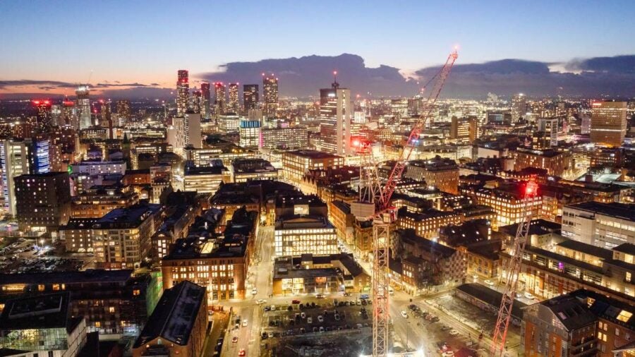
In the wake of the industrial revolution, cities across the north of England were booming. The likes of Manchester, Liverpool and Leeds had grown from mere thousands to hundreds of thousands in about a century. That mass urbanisation made cities the centre of British life.
By 2050, 70% of the world’s population will live in cities up from 56% in 2023, according to the World Bank. The Centre for Cities says that compared with Europe, Britain is already facing a backlog of 4.3m homes that were never built. The government has committed to support the building of 300,000 homes per year, which will not only add populations to city centres, but potentially expand or urbanise smaller towns and cities. Considering these challenges, developers, architects and planners must determine how they can move forward and continue to create urban centres that are liveable and enjoyable for residents.
Underlying the development of the modern city is a collaboration between design, planning and technology. Integrated planning and development will encourage those involved in the built environment to rethink how urban spaces are used, developed and creatively reimagined.
Amanda Levete, founder of architecture firm AL_A, worked with Portuguese energy brand EDP to build a new civic space for Lisbon. In building the Museum of Art, Architecture and Technology, the AL_A noted that Lisbon’s waterfront – where the museum was to be located – was all but inaccessible. It examined the city layout and integrated a bridge into the museum’s design that spanned across a highway and rail line and led directly from the museum’s roof to the heart of Lisbon. “We’ve not only helped reconcile a city whose waterfront was cut off, we created a public space,” Levete said when she presented the work at the London School of Economics’ (LSE) 2021 Urban Age Debates.
This collaboration between a private developer, the city of Lisbon and the creative insight of the architect led to a revolutionary new relationship between Lisbon and the shores of the Tagus River.
Fellow LSE speaker Rozana Montiel, founder of Mexican firm Rozana Montiel Estudio de Arquitectura, said: “When you really observe the topography of a place, you can immediately find possibilities to transform disused urban space and resignify it with little resources.”
That very thinking is a new way of approaching city development. Instead of simply looking at a plot of land, developers, architects and city planners are now thinking about the landscape of the city and the way its spaces will be used.
But, achieving this requires those involved to have a cohesive view of the city in place. Vu.City, a technology platform for urban planning, builds 3D models of cities that integrate everything from sunlight direction to conservation areas to topography to existing and future development. Presenting that information in an interactive 3D model allows architects, city planners and private developers to visualise their development or city in more detail than ever before.
“No longer are you just reading through reams and reams of paragraphs of text or looking at data. You’re actually seeing it visually displayed on a platform,” says Vu.City’s commercial director Claire Locke. Before this technology, she says, different sources could be tapped for information during the planning process. But that was a complicated, tedious task that might have involved the local authority’s website, mapping resources, demographic data, geographical information and more. Seeing all this data in one place makes things simpler for planners and developers. “It’s about making more informed decisions in a quicker time period,” she says.
For developers, technology that visualises a cityscape or development in intricate detail can be a cost saver and efficiency driver. Locke says developers can gain a better understanding of how their development integrates into the city around it. They can then make decisions around improving transport links or access to their development. They can integrate renewable energy sources into their designs. Locke says: “It’s having the information to show you a picture and you instantly see it. You’re doing that before you put a shovel in the ground. You can start to make better decisions. You can get rid of all the ideas that don’t work.”
For architects, creativity is fostered through greater access to data and insights about a space. Senior landscape architect at Stantec, Arlene Decker, says much of her time is spent in front of a computer. She uses 3D modelling, AutoCad drawings and creative software to design and redesign a space.
Understanding how that site fits into the wider landscape is of huge importance. She says: “The work that landscape architects do can vastly improve the relationship between people and civic spaces. By improving the quality of the spaces we have to dwell in and move through”
You can start to make better decisions. You can get rid of all the ideas that don’t work
Decker says landscape architecture can improve peoples’ relationship with their cities: “Ensuring we all have equal access to nature and green spaces greatly improves wellbeing and mental health. Planting trees in our cities and implementing sustainable urban drainage systems, not only beautifies our experience in the city, but it also provides clean oxygen for us to breathe and slows down the water entering our overloaded sewage systems. Even something as simple as a well-placed bench to sit in the sunshine in February can make a huge difference to our civic places.”
Compiling all the aspects of how people interact with city spaces into a single, clear view is a huge asset to developers and architects. Locke says: “To explain everything in detail without visualising it would be incomprehensible.” Because Vu.City allows for collaboration on the same platform, everyone involved in a project can have access to the same insights and information.
Locke adds that this kind of visualisation can also help developers and architects to understand their decisions in context. She points to one example in which a city centre office building used information about the direction of the sun between 12 and 2pm to design an interior courtyard that would be a sunny, inviting place for office workers to have lunch. “We should be sharing information, learning from it and then making better decisions.” she says.
Today, UK cities are still growing, with smaller cities like Milton Keynes and Cambridge rapidly expanding. To support this population growth, cities will need to change. Like in the 18th and 19th centuries, houses will need to be built, transport links deployed, and recreational spaces carved out from urban grids.
Just like when the industrial revolution sparked an influx of people to urban centres, so too the next few decades will be defined by intense urbanisation. Developers and architects will need to ask themselves if they are prepared to meet these challenges. They will have to consider if they are armed with the best technology that they need to do their jobs more effectively, collaborate with the public sector, make better decisions and craft cities worth living in. Without that, they will be left behind.
In the wake of the industrial revolution, cities across the north of England were booming. The likes of Manchester, Liverpool and Leeds had grown from mere thousands to hundreds of thousands in about a century. That mass urbanisation made cities the centre of British life.
By 2050, 70% of the world’s population will live in cities up from 56% in 2023, according to the World Bank. The Centre for Cities says that compared with Europe, Britain is already facing a backlog of 4.3m homes that were never built. The government has committed to support the building of 300,000 homes per year, which will not only add populations to city centres, but potentially expand or urbanise smaller towns and cities. Considering these challenges, developers, architects and planners must determine how they can move forward and continue to create urban centres that are liveable and enjoyable for residents.
Underlying the development of the modern city is a collaboration between design, planning and technology. Integrated planning and development will encourage those involved in the built environment to rethink how urban spaces are used, developed and creatively reimagined.